Scan Tasking
Overview
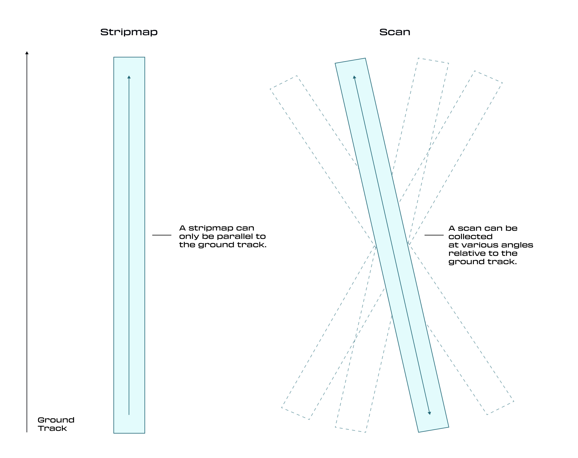
When Tasking in Canopy, you can select Scan as your Imaging Mode, available through both the API and UI, to request and configure Scan Tasks that meet your specific requirements. When your Scan Task is scheduled, it triggers a Dynamic Stripmap Collect, which provides the detailed data required to fulfill your Task. This data is then processed into one or more deliverable Assets.
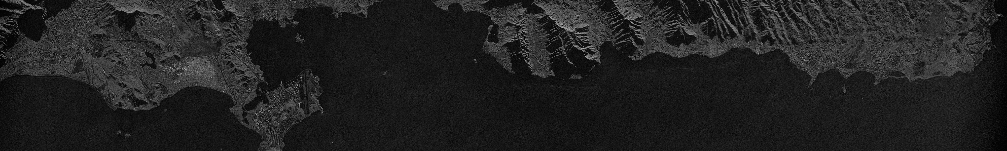
Waimanalo Beach, Hawaii, United States - 2m, 54x8 km
How Scan Mode Works
A Scan can be oriented in any direction across the Earth’s surface. To define a Scan footprint, you must specify two geographic points spaced from 25 up to 100 km apart. These points determine the coverage of the Scan using an 8 km swath width.
Parameters
Canopy allows users to select from various resolution options. The selected resolution directly affects the maximum possible length of your Scan footprint.
For advanced users, additional parameters - such as Polarization and Grazing Angle - can be configured to further refine your Tasking parameters.
| Resolution (m) | Length (km) | Swath Width (km) | Polarization | Suggested Grazing Angle Range |
|---|---|---|---|---|
| 2 | 25 - 100 | 8 | VV or HH | 30° - 60° |
| 1 | 25 - 75 | 8 | VV or HH | 30° - 60° |
| 0.5 | 25 - 50 | 8 | VV or HH | 30° - 60° |
Available Product Types
During Task creation, you can specify one or more product types to define the deliverables you want. The following product types are supported (availability depends on your organization’s configuration):
- SICD: Standard Imagery Complex Data (NITF format).
- SIDD: Sensor Independent Derived Data (NITF format).
- CPHD: Compensated Phase History Data (raw radar data).
- GeoTIFF: Cloud‑optimized GeoTIFF imagery.
For more details on each format, see Delivered Product Types.
Configuring Scan Tasks
API Users
The Scan tasking workflow follows the same process as the Task Lifecycle Tutorial. The only difference is in the Feasibility request, where you provide a LineString geometry and scanConstraints.
Requesting Feasibility
Use the Create Feasibility endpoint with imagingMode: "SCAN". Provide:
- Geometry: a LineString defining your scan path (10–100 km).
- Constraints: polarization, resolution, grazing angle, etc.
- Time window: start and end in ISO8601 format.
curl --request POST \
  --url https://api.canopy.umbra.space/tasking/feasibilities \
  --header 'accept: application/json' \
  --header 'authorization: Bearer ' \
  --header 'content-type: application/json' \
  --data '{
    "imagingMode": "SCAN",
    "scanConstraints": {
      "geometry": {
        "type": "LineString",
        "coordinates": [
          [, ],
          [, ]
        ]
      },
      "polarization": "VV",
      "rangeResolutionMinMeters": 1
    },
    "windowStartAt": "2023-02-02T00:00:00Z",
    "windowEndAt": "2023-02-10T00:00:00Z"
  }'
The response includes a Feasibility ID which can be used to create a feasibility request.
For details on next steps, including: reviewing opportunities, creating a task, and retrieving data, please see the Task Lifecycle Tutorial.
Updated 8 months ago